
City of Toronto investing $82.5 million in Toronto’s Ravine Strategy
April 22, 2021
Today, Mayor John Tory along with Councillor Jennifer McKelvie (Scarborough-Rouge Park) and Chair of the Infrastructure and Environment Committee, marked Earth Day by highlighting the City’s $82.5 million investment this year in the Toronto’s Ravine Strategy.
The $82.5 million in funding for the Ravine Strategy includes:
- $12.4 million in operating funding through Parks, Forestry and Recreation – a 10 per cent increase from last year despite an incredibly tough 2021 budget due to the ongoing pandemic.
- $70.1 million in capital investments across numerous City divisions including Parks, Forestry and Recreation, Transportation Services and Toronto Water as well as the Toronto and Region Conservation Authority (TRCA).
The increased investment in Toronto’s Ravine Strategy this year will allow for:
- Enhanced litter pickup in ravines and increased focus on addressing incidents of illegal dumping, activities that can seriously harm ravines. Last year, City staff removed 74 tonnes of garbage and 14 tonnes of recyclable metal from 97 hectares of ravine land. Litter pickup will increase by about 30 per cent as a result of additional funding.
- Expanded invasive species management. Last year, staff controlled invasive plant species over 234 hectares of ravine land. The extra funding will see staff manage invasive species over up to 300 hectares in 2021.
- Enhanced youth internships through the ravine youth team program which is a paid summer internship program for post-secondary students, offered in partnership with TRCA. The program provides work, professional development and opportunities for youth to build and expand their networks through a wide range of activities that support and contribute to the ravine strategy. Applications for the 2021 program will open soon .
- Additional capital projects that will improve well-used and well-loved trails and pathways and the overall user experience of Toronto’s ravine system, including the West Don Trail through E.T. Seton Park.
Ravines are a major part of Toronto’s green infrastructure, and along with parks and tree canopy, provide many environmental, health and recreational benefits. They are a part of a larger watershed system, helping to filter and convey stormwater, enhance biodiversity and reduce urban heat. Ravines also contain grey infrastructure, such as utilities and sewer lines, and some of the busiest roads and trails that help move people through the city, such as the Don Valley Parkway and Lower Don Trail.
Province announces infusion of funding for BC Parks
Promises for more campsites, expanded trails, and management—with details on Sea to Sky parks to come 2 days ago By: Alyssa Noel
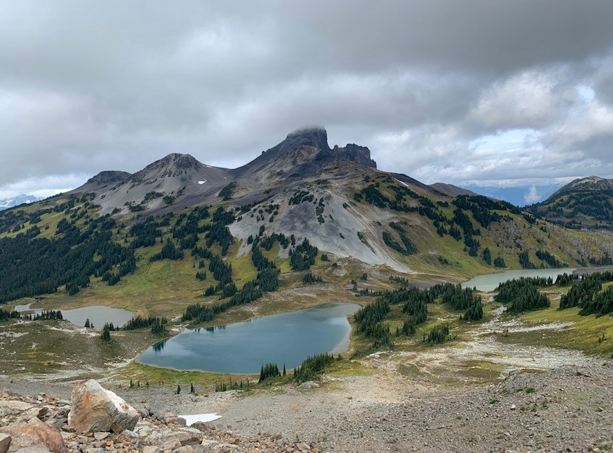 The provincial government has earmarked a record amount of funding for BC Parks over the next several years. Details on how that will impact Sea to Sky parks, like Garibaldi Provincial Park, pictured here, have not yet been announced. PHOTO BY ALYSSA NOEL
BC Parks will add two new summer employment opportunities in the Sea to Sky this year.
A planning intern and an administrative intern will be based at Alice Lake Provincial Park in Squamish for 14 weeks, but “they are supporting parks in the region,” a spokesperson for B.C.’s Ministry of Environment & Climate Change Strategy said in an email.
In total, $4 million has been set aside for the youth employment program with BC Parks and the BC Conservation Officer Service to fund 83 positions. That includes 37 youth positions with BC Parks and 46 with the Conservation Officer Service.
The jobs will be spread throughout the province with job posts set to go up in the coming days.
The Canadian Parks and Wilderness Society (CPAWS), BC Chapter, applauded the additional summer positions.
Local Flavours: The Complete Guide to Riding in Fernie, British Columbia – from Pinkbike
THE COMPLETE RIDING GUIDE TOFERNIE, BRITISH COLUMBIAWords, photos, & video by Ben Haggar
Presented by
Tourism Fernie
Note from the author: 2020 was weird and 2021 is shaping up to be just as unpredictable. It’s hard to know what travel will look like this year for both domestic and international tourism in BC. What I do know is that daydreaming about these incredible riding destinations and making plans for when travel is both safe and responsible is good for the soul and keeps me motivated to ride the trainer in my garage.This episode was produced in August 2020 when BC Covid cases were extremely low, travel was allowed and all pertinent safety measures were taken into consideration from face masks, physical distancing and buckets of hand sanitizer. For updated advise on travel restrictions and provincial guidelines visit the BC CDC website and Tourism Fernie’s Covid-19 travel section. Enjoy, keep dreaming and stay safe out there.
Fernie sits right in the south-eastern corner of BC, nestled in the picturesque Elk Valley. The landscape is classic Canadian Rocky Mountains with emerald rivers flowing through heavily wooded valleys and towering limestone peaks reaching skywards as far as the eye can see. The riding here mirrors the natural terrain with easier green and blue trails generally lower in the valley with the black and double black trails beginning higher in elevation where the mountains become steeper.
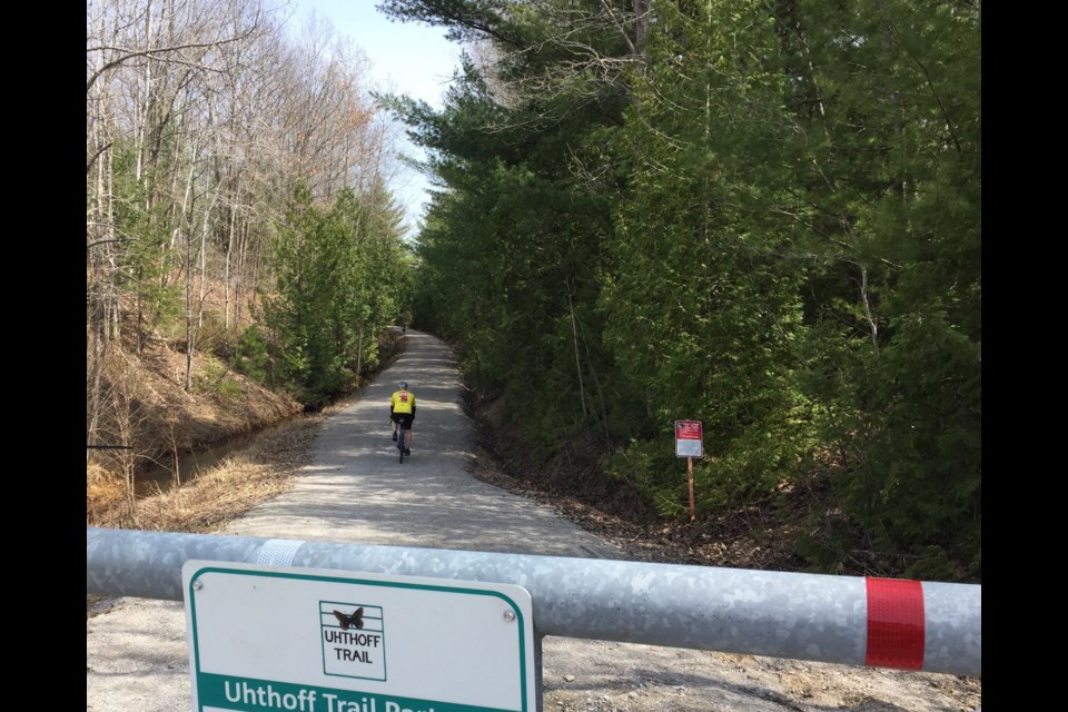
Cycling around lake offers an adventure in history – Orillia Matters.com
Cycling is a permitted activity during stay-at-home orders and this 55-kilometre route offers something for every one.
about 2 hours ago By: Kathy Hunt
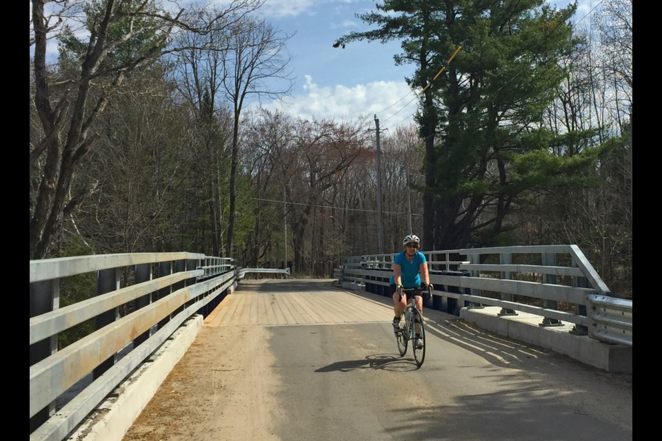
Cyclists, and others, are happy to find the bridge at Lock 42 open, after a long closure to restore the Trent-Severn Waterway bridge.Kathy Hunt/OrilliaMatters
If you feel like going for a bike adventure, but can’t go too far from home, here’s a route that takes you around Lake Couchiching that has lots of opportunities for exploring.
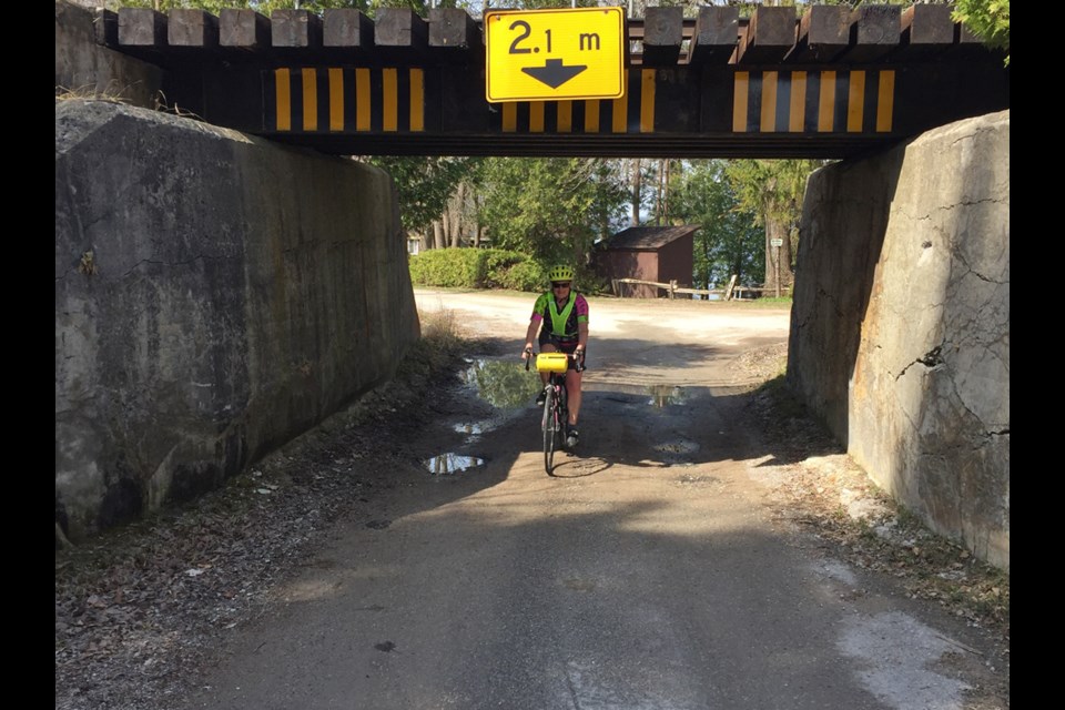
The 55-km route, starting from the Atherley Narrows, travels through two townships, the Chippewas of Rama First Nation, the City of Orillia and features three unique national historic sites. It also passes through or nearby lakeside parks, Simcoe County forests, and offers a variety of trails and paved roads, suitable for road or gravel bikes.
The first historic site on the route is the Mnjikaning Fish Weirs, the largest and best preserved wooden fish weirs known in eastern North America. The weirs were in use from about 3300 BC until the recent past. Today the Anishinaabeg are stewards of the site.